News - GLOBE Observer
GLOBE Land Cover Challenge 2022: Land Cover in a Changing Climate

On July 23, 1972, a Delta 900 rocket blasted into space from
Vandenberg Air Force Base in California carrying, Landsat 1, the first
satellite designed to study Earth’s land. “In the early 1970s, Landsat
was our first tool to provide global imagery,” says Christopher Neigh,
Landsat 9 project scientist at NASA Goddard Space Flight Center.

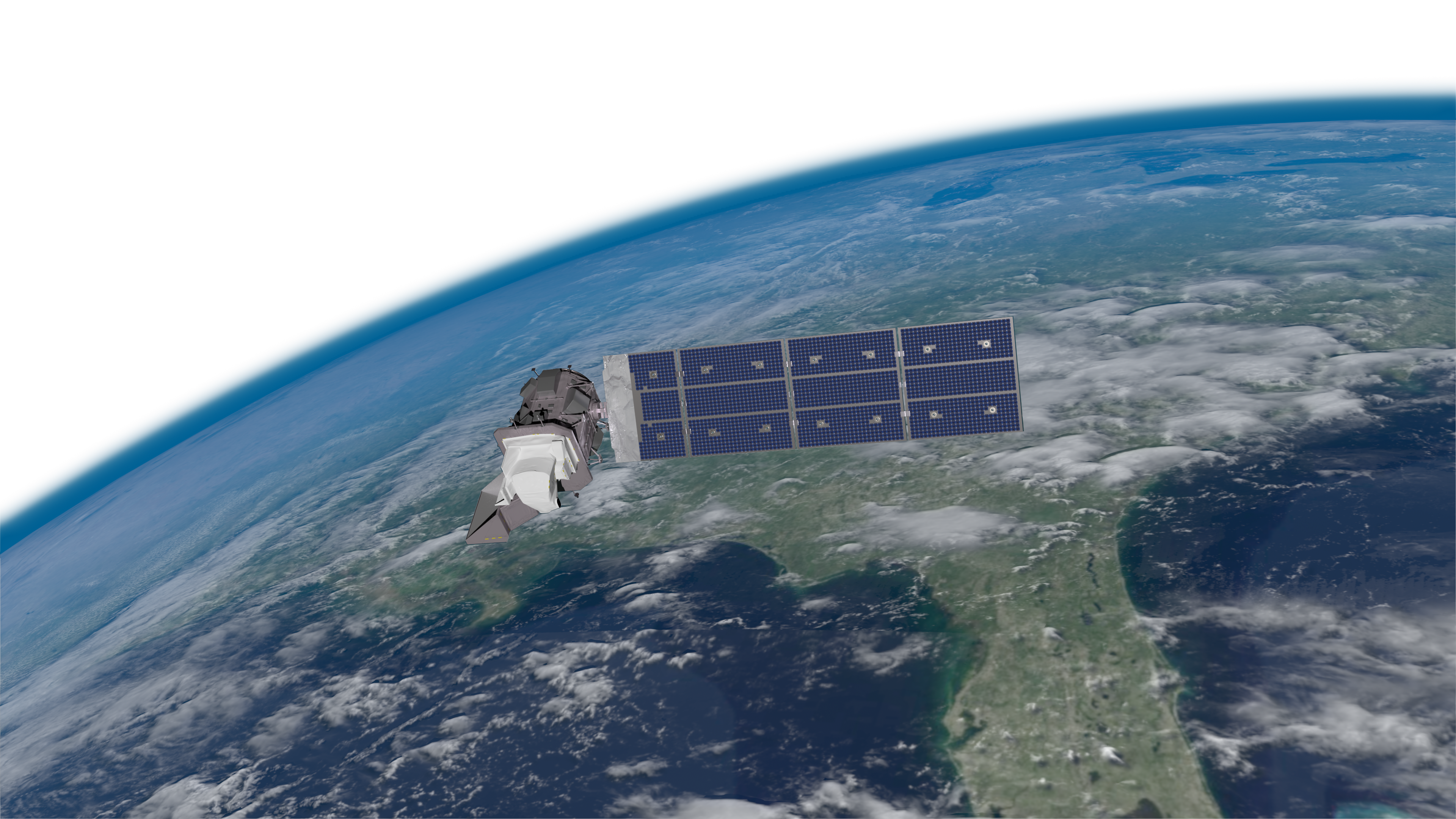
A visualization of the newly launched Landsat 9 satellite over the
Gulf of Mexico, courtesy NASA Science Visualization Studio.
The view was necessary. “Our Earth is continuously changing,” says Neigh citing both natural changes from events like wildfires or droughts and human-generated changes from land use. From Landsat 1 through Landsat 9, the joint U.S. Geological Survey and NASA Landsat Program has maintained at least one Landsat satellite in continuous operation since 1972. As a result, Landsat has provided “a priceless 50-year record of land surface change, our longest record to date,” says Neigh. Among the changes, the record shows us how land around the globe is responding to climate change.

Landsat's long record documents change over time, such as the
recession of the Columbia Glacier in southeastern Alaska. The left
image was taken by Landsat 4 in 1986, while the right image comes
from Landsat 8 in 2019. Images courtesy NASA Earth Observatory.
While the Landsat satellites’ long record can show change happening, it doesn’t always show why change occurred. This is where volunteer observations from The GLOBE Program may be able to help. You can provide information from the ground including both detailed photographs and notes reporting local knowledge about change.
“We are holding the GLOBE Land Cover Challenge 2022: Land Cover in a Changing Climate both to mark the 50th anniversary of the Landsat Program and to provide information to support its remarkable record of land cover,” says Holli Kohl, GLOBE Observer coordinator at NASA Goddard Space Flight Center. The challenge runs 26 July 26 through 26 August 2022.
“Scientists are predicting changes on the land related to climate into the future,” says Peder Nelson, a scientist studying land cover at Oregon State University and the GLOBE Observer Land Cover Science Lead. “We can be part of the science process of collecting data to check the predictions with our photos and with our observations during the data challenge.”
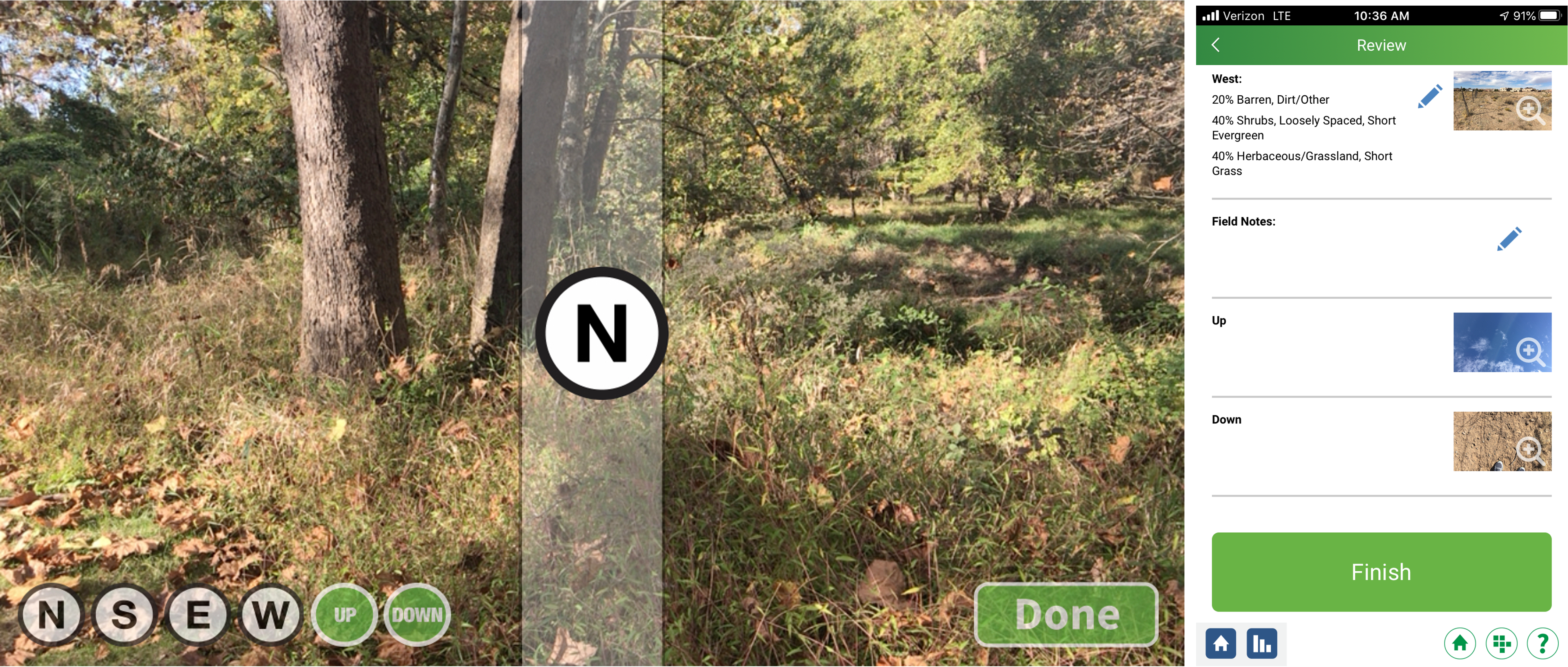
To participate in the challenge, choose any location, then use the GLOBE Observer app to photograph the land in each cardinal direction, then submit the photos to GLOBE. If you document a location that has changed, you can add information about the change in the field notes. Observations from any location—whether it has changed or not—are valuable.

Capture photos of land cover using the GLOBE Observer app (left),
then tell us what you know about the site in the field notes section
of the final screen of the protocol (right).
If you contribute 25 unique observations between 26 July and 26 August, we will send you a digital Landsat image of one of your observations. If you contribute 50 or more unique observations during the challenge, we will mail you Landsat commemorative material. (A unique observation is data collected at different locations or on different dates from the same location.)
You can also participate in the challenge by joining Camp Landsat for five weeks of fun. This virtual camp explores a new theme each week about how Landsat has helped us better understand our home planet. Like early voyagers mapping lands unknown to them and space telescopes providing new information about the universe, Landsat satellites have given us new perspectives about the world we live in.

Participate in the GLOBE Land Cover Challenge 2022 by joining Camp Landsat.
You can keep up with the challenge throughout the month by following The GLOBE Program and Landsat on social media for weekly Reels from Landsat scientists between July 22 and September 2. Share your best observations with the hashtags #GLOBELandCoverChallenge and #Landsat.
Landsat 1 set the foundation for what has become a 50 year record of Earth’s land from space, a record that Landsat 9 continues today. You can set the foundation for your own record of land cover by documenting land that you care about. “We want you to go out and contribute to photographing Earth today to complement this long memory so that people in the future can understand what we experienced and can make better sense of the satellite observations,” says Nelson. “We are now celebrating the semicentennial of Landsat’s legacy,” says Neigh. “May its continuous record enable us all to be good stewards of our home planet.”
Comments
View more GLOBE Observer news here.


