News - GLOBE Observer
Tracking Change in Dixie National Forest
As the app of the GLOBE Program, GLOBE Observer is used to collect environmental data in support of Earth system science. All observations collected become part of a free and open database accessible to scientists and students around the world for research.
However, GLOBE protocols can also be used to research issues at a local scale. College student Callie Davis used GLOBE Observer land cover as a tool in her 2024 internship with Dixie National Forest to recreate a series of landscape photos her parents took nearly 30 years ago. She shares her experience here.
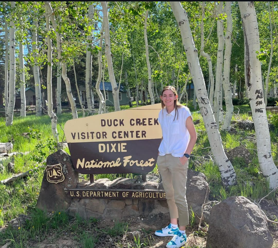
Callie Davis, a landscape architecture student, interned at Dixie National Forest for the summer of 2024. During her internship, she used GLOBE Observer to recreate historic photos to document change in the forest.
This past summer, I had the opportunity to collaborate with the GLOBE Observer team while working for the US Forest Service through Southern Utah University’s Intergovernmental Internship Cooperative program, based in Cedar City, Utah, on the Dixie National Forest’s Cedar City Ranger District. The project I participated in involved recreating over 200 photo points that were originally taken 27 years ago by my parents, who were conducting a scenery management study for the Forest Service.
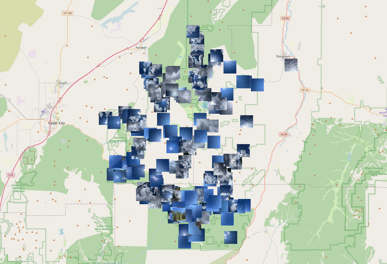
GLOBE Observer Land Cover data collected in and around Dixie National Forest in 2024, most of which are photos Callie Davis took during her summer internship.
The process itself was both technical and adventurous. Using the land cover tool in the GLOBE Observer app, I collected data at each location where the original photos had been taken. The original photo sites had been identified using GPS. These coordinates guided me back to the exact locations of the repeat points, allowing me to capture new images and document how the landscape had changed over time.

In recreating photos taken by her parents (left), Ms. Davis captured a near-identical photograph (right) of a dead tree at the foreground of a spectacular scenic view. At first glance, this area doesn’t seem to have changed significantly. A close look shows a forest in transition, says Nancy Brunswick, a regional landscape architect with the Forest Service Intermountain Region. Light green areas in 1997 were aspen forest. By 2024, those shades of light green had been replaced with dark green pine forests. Brunswick championed the internship to document changes in the forest such as these.
One of the most striking aspects of this project was seeing firsthand how much the landscape has changed in some areas and remained almost untouched in others. Some of the most drastic changes that affected the landscape were caused by fire. In several areas where large, mature pine forests once stood, I found mountainsides left bare by recent fires. These areas felt nearly desolate, however, nature’s resilience was present. In many of the burned regions, young aspens had sprung up, forming a thick, vibrant new cover. It was a reminder of how ecosystems regenerate, even after such destructive events.
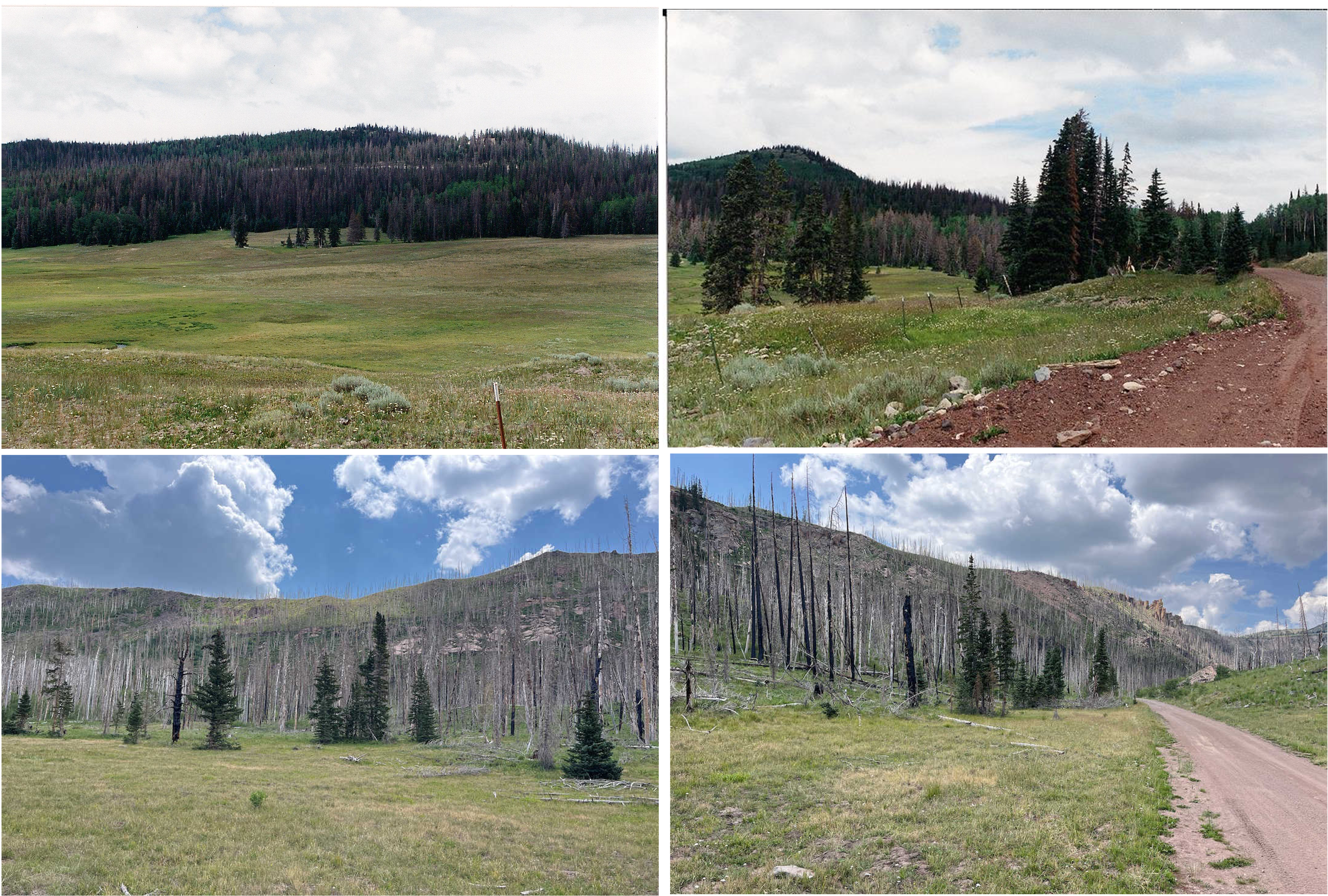
The top two photos show this hillside in 1997. Orange and brown
trees scattered through the dense green forest indicate a bark
beetle infestation. Beetle-killed trees would become ready fuel for
the massive Brian Head Fire, which burned through this area in 2017.
Ms. Davis took the lower photos of the recovering hillside in 2024.
In addition to the fire-scarred areas, I saw the effects of bark beetle infestations, which had begun in mature spruce trees around the same time my parents took the original photos. The beetles had killed off many trees, leaving behind patches of deadwood that were now being logged. The presence of logging operations could often be found in many of the areas that had been affected by impact to the landscape.

This photo pair also shows the impact of bark beetles on Dixie
National Forest. In this case, dead trees were removed, thinning the
forest significantly between 1997 (left) and 2024 (right).
Development was also evident in small communities scattered throughout the forest, which have grown significantly since the original photos were taken. Elements of development included recreational homes, roads, and other infrastructure.
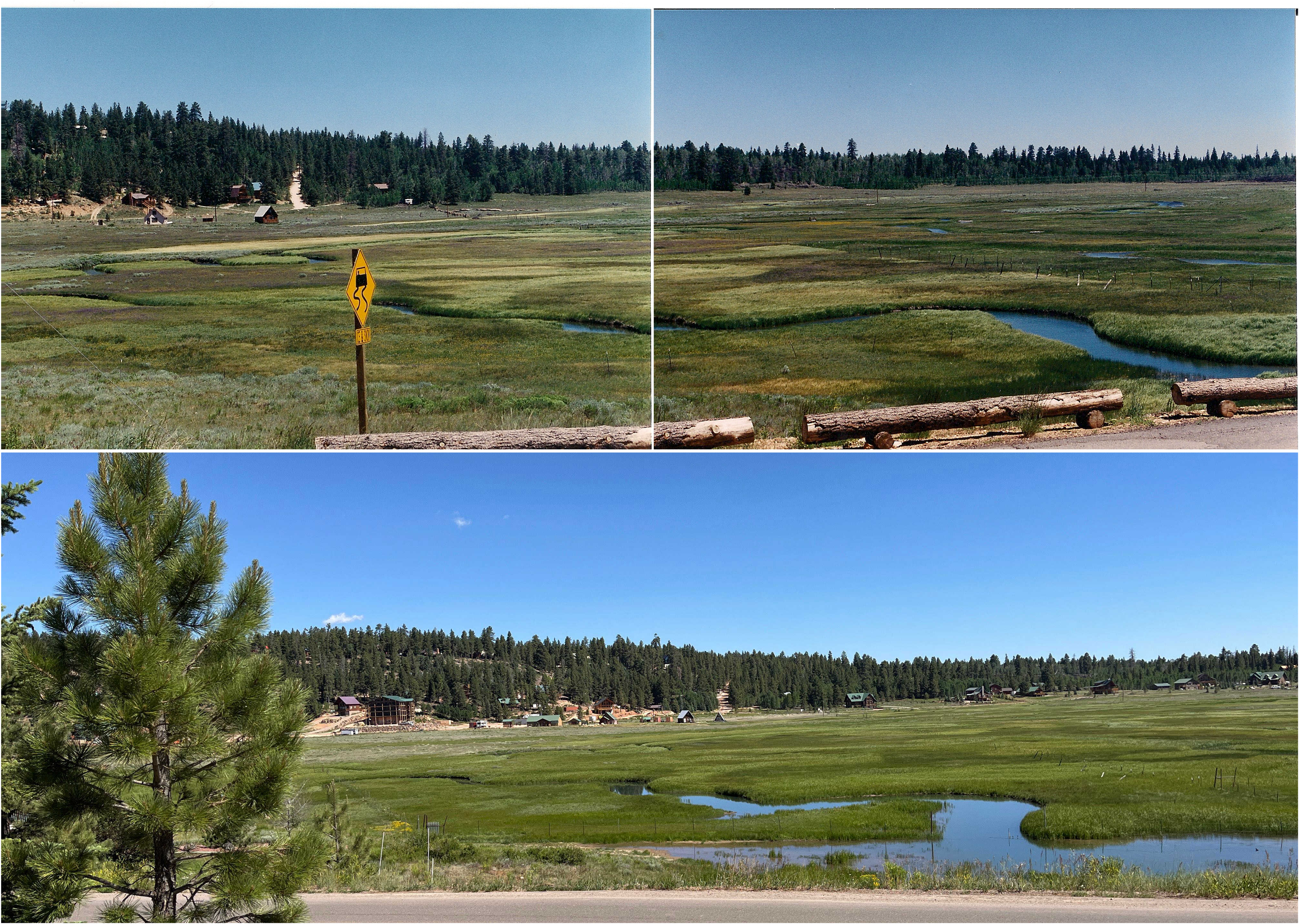
The Duck Creek community showed significant growth between 1997, top, and 2024. Cabins were concentrated on the left side of the area photographed in 1997. By 2024, buildings were spread across the valley along the forest front.
What made this project even more special to me was the connection to my family. Revisiting the same sites my parents had documented nearly three decades ago gave me a unique perspective. I grew up hearing about the importance of managing lands and visual resources so everyone can enjoy the unique natural landscapes today and in the future. Now, seeing the same places with my own eyes and recording how they have changed, I felt like I was continuing a legacy. This was an incredible opportunity to be able to participate in and to be able to continue the work that my parents started.
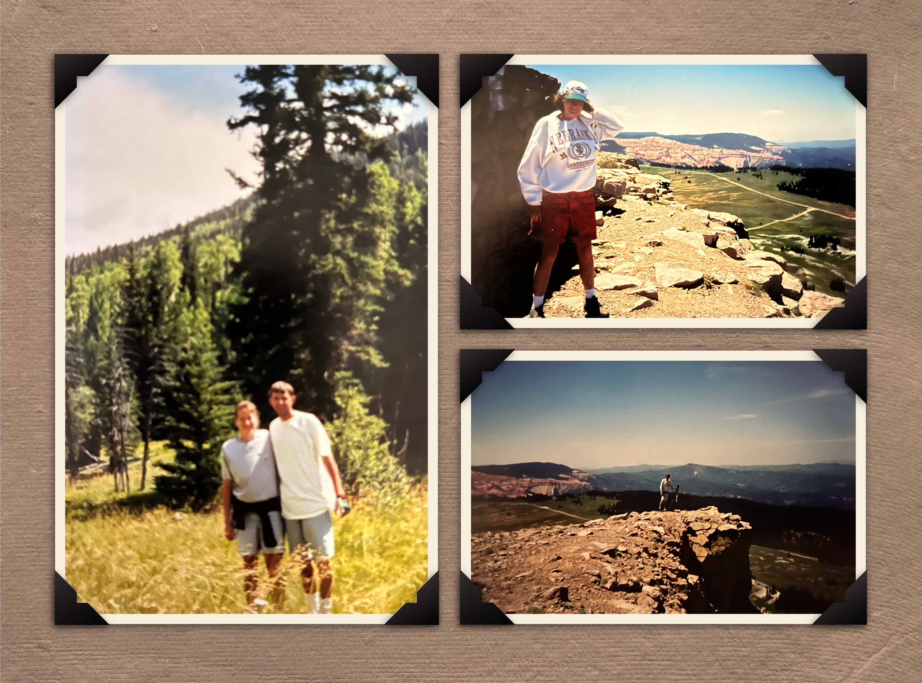
Jeff and Jackie Davis surveyed Dixie National Forest as part of a
scenery management study in 1997. Both were students in landscape
architecture at Utah State University at the time.
This experience also deepened my appreciation for the importance of long-term landscape management. The data we collected will be invaluable for future research, helping to guide decisions on how to maintain and manage these forests in a way that preserves their beauty and ecological integrity. As someone pursuing a career in landscape architecture, this project reinforced my belief in the need to balance human activity with the preservation of natural spaces. The landscapes we enjoy today are the result of careful planning, and it’s up to us to ensure they remain healthy and vibrant for future generations.
If you are interested in using GLOBE as a tool for research in your community, the GLOBE Observer app offers a mechanism to set up a local research project. You can submit a project to GLOBE Observer which, after review, will appear in the app in your community. The project will invite other GLOBE Observer volunteers to collect data to support your project. GLOBE welcomes more community-based projects such as this one in the Dixie National Forest!
About the author:
Callie Davis is currently a student at Utah State University, where she is a sophomore in the Landscape Architecture and Environmental Planning Department.
After her education Callie intends to pursue a career in the creation of modern, efficient, and elegant spaces with interconnections that leave a legacy of thoughtful design, balancing the needs of communities and natural environments.
Watch the recording of the discussion of this project during the GLOBE Observer Connect session from 12 December 2024:
Comments
View more GLOBE Observer news here.


