News - GLOBE Observer
New Science Publication Analyzes GLOBE Trees Data
Knowing the height of trees in Earth’s forest is critical for understanding a forest’s health, biodiversity, and the amount of carbon it stores. But measuring tree height can be challenging. Traditionally, scientists have gone to forests to manually measure trees - a labor intensive process that results in a limited number of measurements. Recently, the ICESat-2 satellite and the space-based GEDI instrument have provided data about forest height and shape, but ground-based measurements are still essential to help scientists verify the data from these instruments.

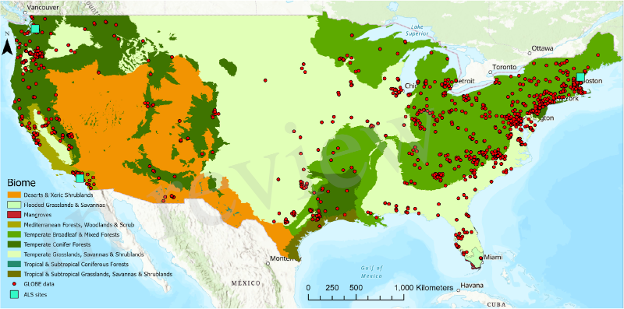
Mei-Kuei Lu and Sorin C. Popescu, scientists at Texas A&M University, and Brian Cambell, the GLOBE Observer Trees lead, recently published a paper that examined GLOBE Observer Tree height data in comparison to ICESat-2 and GEDI data. They wanted to assess if GLOBE Observer data could verify space-based tree height measurements in different types of forest ecosystems. The space-based tree height observations coming from the NASA ICESat-2 Mission, the GEDI – Landsat derived global map, and the GEDI-Sentinel-2 fusion were all part of the comparison data products used with the GLOBE Observer Trees Tool data for tree height.
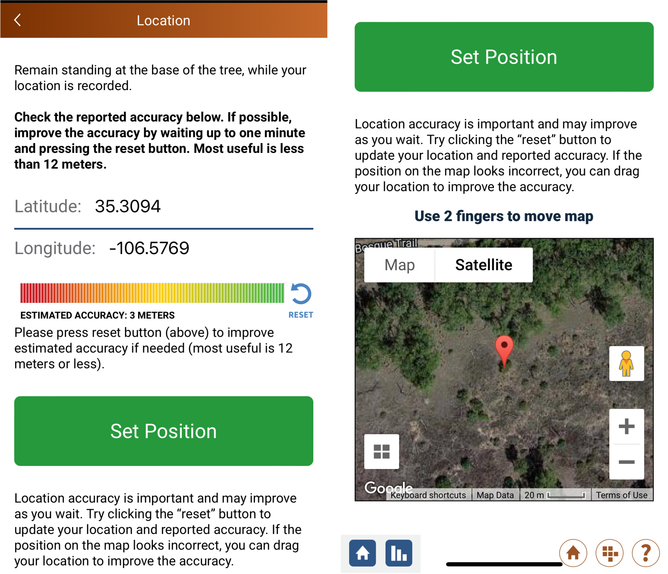
They found that GLOBE Observer location accuracy made it challenging to match Trees data to the satellite measurements. Cell phones measure location with varying precision. They recommend that GLOBE Observer volunteers refresh the location until the accuracy is under 25 meters. Alternatively, volunteers can move the location pin on the map to align exactly with the tree.

To improve the accuracy of your GLOBE Observer Trees measurements,
click the reset arrow until the estimated accuracy is under 25
meters. If you know where the tree is, move the pin on the map to
set the exact location.
Second, much of the existing GLOBE Trees data is in or near cities. To better support satellite assessments, the scientists are requesting tree height measurements from natural settings. Additional data from natural locations will help verify average tree height in a greater variety of ecosystems.
You can check out the paper here: “Use of GLOBE Observer Citizen Science Data to Validate Continental-Scale Canopy Height Maps Derived from ICESat-2 and GEDI”
Comments
View more GLOBE Observer news here.


