News - GLOBE Observer
NASA in the Snow
NASA intern Julia White was working to make sense of the data coming from the Natural Resources Conservation Service’s (NRCS) Snow Telemetry network, or SNOTEL, a set of ground-based instruments measuring snow depth and density, the amount of water in the snow, and air temperature. While studying snow from space and the ground, she wanted to know when the snowpack began to form, and for that, she needed to validate whether or not the SNOTEL instruments correctly reported when snow was on the ground. The data she was evaluating was from mid-October 2022, a time of year when snow can fall and melt or fall and remain until spring. But on one day, the instruments measured a significant increase in snow water equivalent, but no snow. It didn’t make sense.

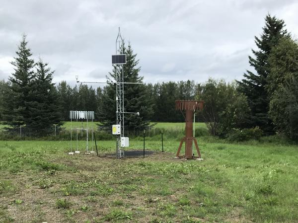
A Snow Telemetry Network, or SNOTEL, site includes multiple instruments to measure snow depth, density, snow water equivalent, and air temperature. This photo, taken during the summer, shows a site near Fairbanks, Alaska, that was included in White’s research. Photo courtesy USDA.
A graduate student at the University of Alaska Fairbanks working with NASA Goddard Space Flight Center scientists Carrie Vuyovich and Alicia Joseph and with Christina Buffington, University of Alaska Fairbanks scientist and the GLOBE Implementation Office Deputy Director of Training, Education, and Public Engagement, White was doing the research as part of NASA’s SnowEx experiment. SnowEx is a multiyear field experiment that uses a variety of methods to study snow cover in different landscapes with the goal of designing a satellite capable of measuring snow worldwide.
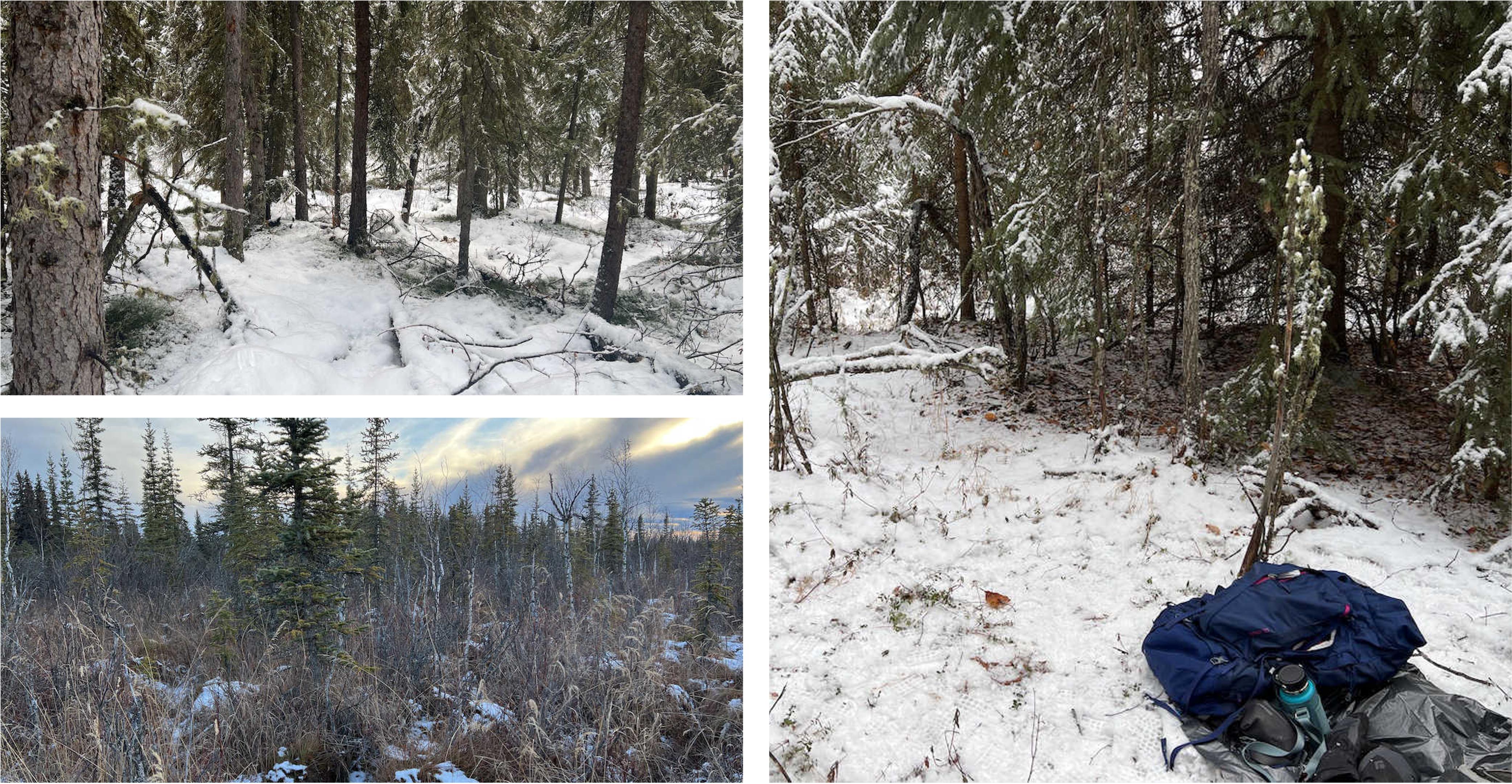
“I wanted to use all resources I could find to see what was happening with the SNOTEL data,” says White. Normally, that meant checking data from Landsat or Planet satellites, but none were available for that location on that day. She decided to check the GLOBE database for the time period around the suspicious data point. Serendipitously, a GLOBE Observer had submitted land cover observations of the site in the right timeframe. The GLOBE land cover photos showed snow on the ground. “The GLOBE data confirmed that there was a glitch in the SNOTEL measurement,” she says.

GLOBE Observer land cover observations taken between October 18
and October 23, 2022, confirm the presence of snow on the ground
near the SNOTEL site. Photos courtesy GLOBE.
Why did it matter if snow was on the ground? White’s internship contributed to research about snow water equivalent (SWE) across Interior Alaska, where ground-based data are typically sparse. The project integrated satellite-based interferometric synthetic aperture radar (InSAR) data from the Sentinel-1 satellite with ground-based SNOTEL and GLOBE data.

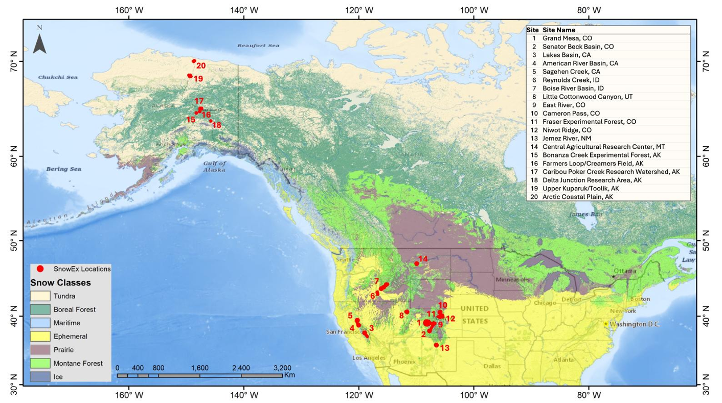
This map shows the location of SnowEx study sites. Map courtesy NASA SnowEx.
By combining these space and ground-based perspectives, the SnowEx team hopes to better understand how snow water equivalent varies across the landscape and how it affects local ecosystems and communities. The work also laid the groundwork to evaluate data from NASA’s new NISAR (NASA ISRO Synthetic Aperture Radar) mission, which has shown promising potential for measuring snow water equivalents expected to improve measurements of snow water equivalent.
Eventually, the work could lead to the development of a new satellite instrument that can measure snow water equivalent globally. Knowing how much water is available in snow worldwide is critical because more than one-sixth of the world’s population, some 102 billion people, rely on snowmelt for their water supply. And yet, no single satellite-based instrument can measure the amount of water available from snow, also known as snow water equivalent.

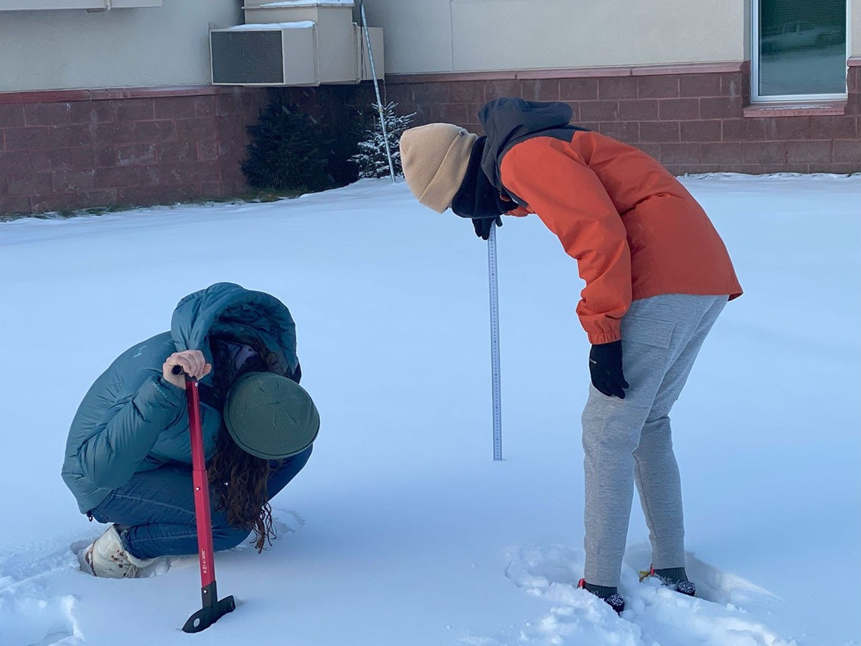
Julia White and a Delta Junction student following GLOBE protocols
for snow depth. Photo courtesy Tori Brannan.
It wasn’t just luck that GLOBE data existed near the SNOTEL site. Vuyovich had taken the observation while she was in the area doing field work. Additionally, SnowEx collaborated with students and the community to collect ground data. Students at Delta Junction Junior High and High Schools used GLOBE to monitor snow depth and snow water equivalent in a snowdrift near the school to collect data from SnowEx and to do their own research. The SnowEx team also collaborated with the Delta Junction Trails Association to collect GLOBE Observer land cover photos and snow depth and SWE data. It’s an ideal example of how communities, schools and scientists can work together to benefit all three groups.
Julia White presented work done during her internship at the 2025 GLOBE Annual Meeting. Her presentation begins at 10:50 in this session.
“The photos are so valuable because they give so much detailed information about what is going on in a specific place,” says White.
To participate in this and other research projects near you, watch for the data request notification in the upper right corner of the GLOBE Observer app home screen.
This article is adapted from a NASA article, Linking Satellite Data and Community Knowledge to Advance Alaskan Snow Science, and from Julia White’s presentation during the 2025 GLOBE Annual Meeting.
Comments
View more GLOBE Observer news here.


