News - GLOBE Observer
Documenting Extreme Earth Events using the GLOBE Observer App
By Russanne Low, GLOBE Observer Science Team
Natural disasters are catastrophic situations in which the day-to-day patterns of life are suddenly disrupted and people lose access to essential resources they need to have a healthy life. Extreme Earth events, such as hurricanes, floods, earthquakes, and wildfires can result in a natural disaster.
This summer has been characterized by numerous extreme Earth events. We saw record-breaking high temperatures from Siberia to Death Valley and wildfires raging in Colorado, the Amazon and California. The hyperactive Atlantic hurricane season has named 25 storms so far, setting several records including the earliest start of the Atlantic storm season and the most storms in September. Derechos, which are straight-line storms with wind velocities over 58 mph, are as common in the Midwest U.S. as hurricanes are in Florida, but rarely make national news. However, this summer’s derecho in Iowa with gusts of 140 mph caused over a billion dollars in damage and made derecho a household word.
2020 is now the costliest year on record for natural disasters in the United States. And yet scientists predict that extreme Earth events will become more frequent and more powerful as the climate warms. Dr. Waleed Abdalati, Professor of Geography at the University of Colorado and NASA’s former chief scientist, says we should expect more of what we saw this past summer: stronger winds and more drought and flood events. [1]
The Earth’s atmosphere is a giant heat engine. It powers hurricanes and rearranges rainfall patterns to create floods in some areas and drought in others. When one part of the Earth system experiences change, that change is propagated into other parts of the system. A warm atmosphere transfers heat to create higher sea surface temperatures (SSTs). The higher SSTs power hurricanes, which in turn can destroy beaches, knock down trees, and blow swarms of mosquitoes inland. This causal event chain is a simple example of how air, water, land and life are all interconnected by the Earth system’s fluxes of matter and energy.
Like much of the western U.S., Colorado has been experiencing extreme drought all summer. The dry conditions in Colorado are part of a broader pattern of intensifying dryness in this region, exacerbated by climate change. Historic dry conditions are responsible for the expansion of the Cameron Peak Fire, the largest fire in Colorado history, which has now burned over 260 square miles since mid-August and is still not controlled.
What does this have to do with GLOBE Observer? GLOBE Observers collect data opportunistically. This means that scientific data is collected by citizen scientists whenever and whenever they want to do so, rather than using a specific sampling strategy developed for a specific research question.
As a GLOBE Observer scientist and enthusiast, I use the GLOBE Observer app to document land cover and mosquito habitats on my frequent bike rides near my home. Scientists use satellites to quantify land cover on the surface, but ground observations by citizen scientists are also necessary, not only to verify satellite data but also to document understory land cover elements obscured by the tree canopy, and to identify microenvironmental conditions such as standing water where mosquitoes breed.
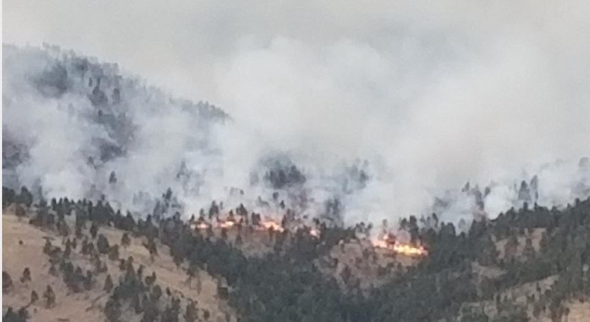
One thing about opportunistically-collected scientific data: you never know when it might be useful or relevant. This past year, I made several observations where the Calwood Fire in Boulder County, Colorado is now burning. At this writing, I am evacuated from my home because of the local wildfire threat. Here is a recent view of the area where I made my GLOBE Observer observations in March 2020:

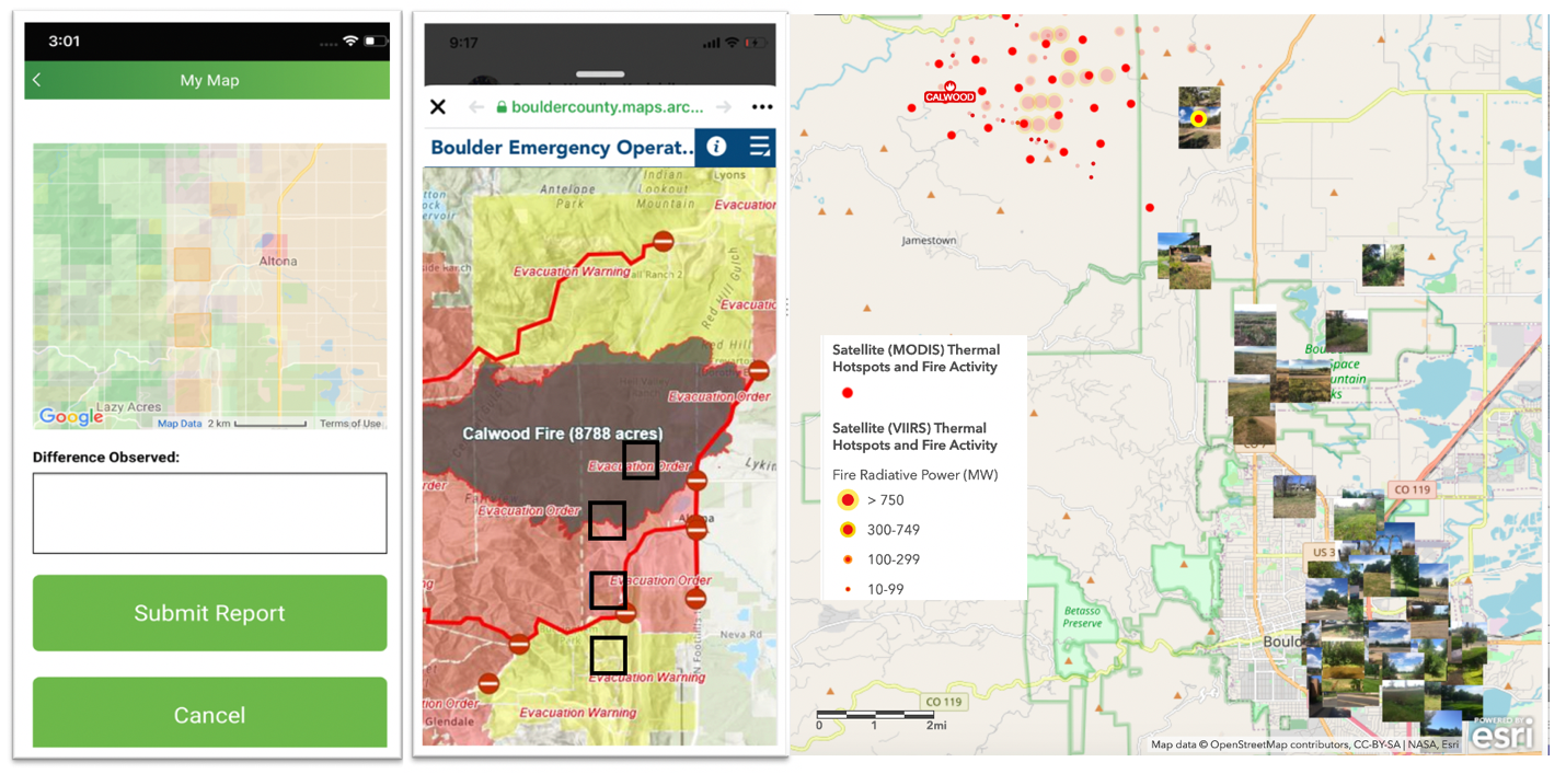
A quick look at the My Land Cover Map visualization in the GLOBE Observer app shows four of my observation sites from this spring, two of which are within the active burn area just west of the historic town of Altona.

The GLOBE Observer citizen science data I collected have just become priceless. It took me just a few minutes to make these observations, but the photos and descriptions are possibly the only observations ever made at this location before the wildfire. The pictures provide baseline data about the vegetation at this site, and the labels from the GLOBE Observer classification provides an estimate of the land cover before the fire.
It’s important for other citizen scientists to realize that my contributions are hardly unique: I am in the company of other GLOBE Observers who have also contributed “priceless” land cover data. According to Peder Nelson, science lead for GLOBE Observer Land Cover, GLOBE Observers have documented sites within five wildfire burns this year. In fact, one of the reasons why Nelson is excited about GLOBE Observer is that he knows the scientific value of obtaining land cover information before a hazard happens: “we can never recreate that data.”
GLOBE Observers have the opportunity to ramp up the usefulness of their scientific observations by making repeat observations of the same site over the course of time, documenting changes that take place over seasons and in response to environmental phenomena. It’s not safe now for me to enter the burn perimeter, but in the coming months and years, GLOBE Observer will be an important tool as citizen scientists document the changes taking place on the landscape after the burn.
Is your area experiencing extreme events this year? How could you use GLOBE Observer to document Earth system changes in your region? Check out the satellite imagery for recent extreme Earth events in your region on NASA Worldview. Learn more about the GLOBE Observer Land Cover app by watching the "Why Observe: Land Cover" video.
NOTE: Always follow guidelines from your local officials, and only participate in GLOBE activities or use the GLOBE Observer app if it is safe to do so.
View Dr. Low's Land Cover observation photos:
Comments
View more GLOBE Observer news here.


