Eclipse 2024 Data - GLOBE Observer
Eclipse Data - 08 April 2024
For time-limited events such as eclipses, we have pulled curated data sets that might be useful for a variety of people, and could save time in accessing the data. See below for air temperature, clouds, land cover, and wind data sets pulled for the date of the total solar eclipse on 08 April 2024.
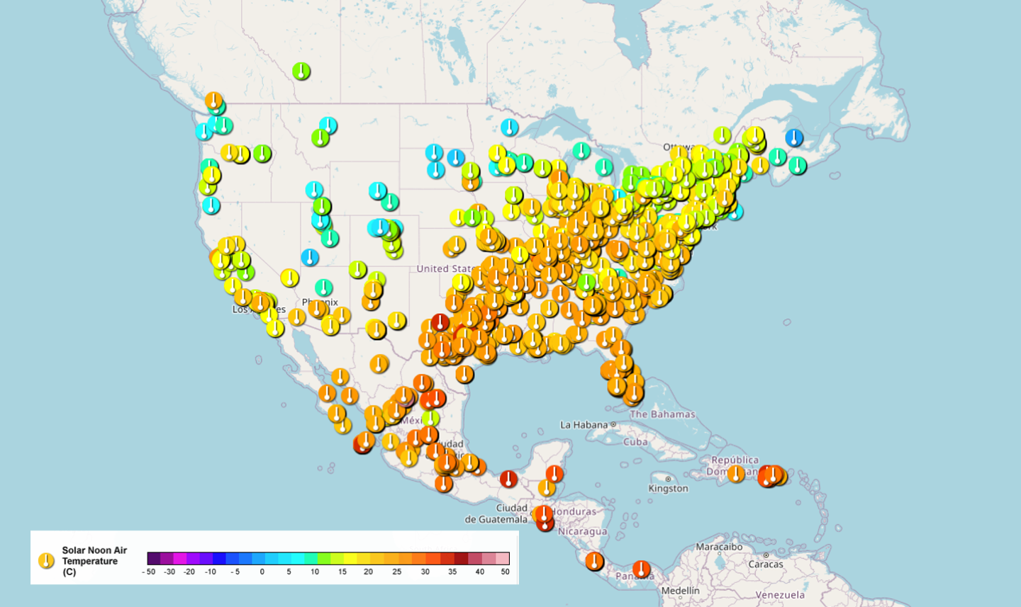
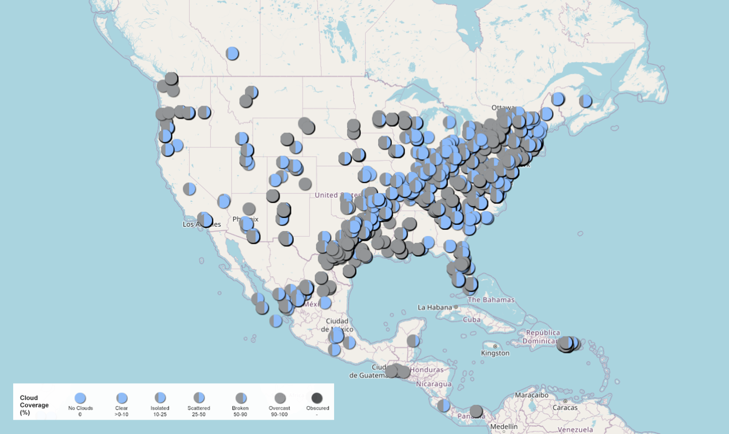
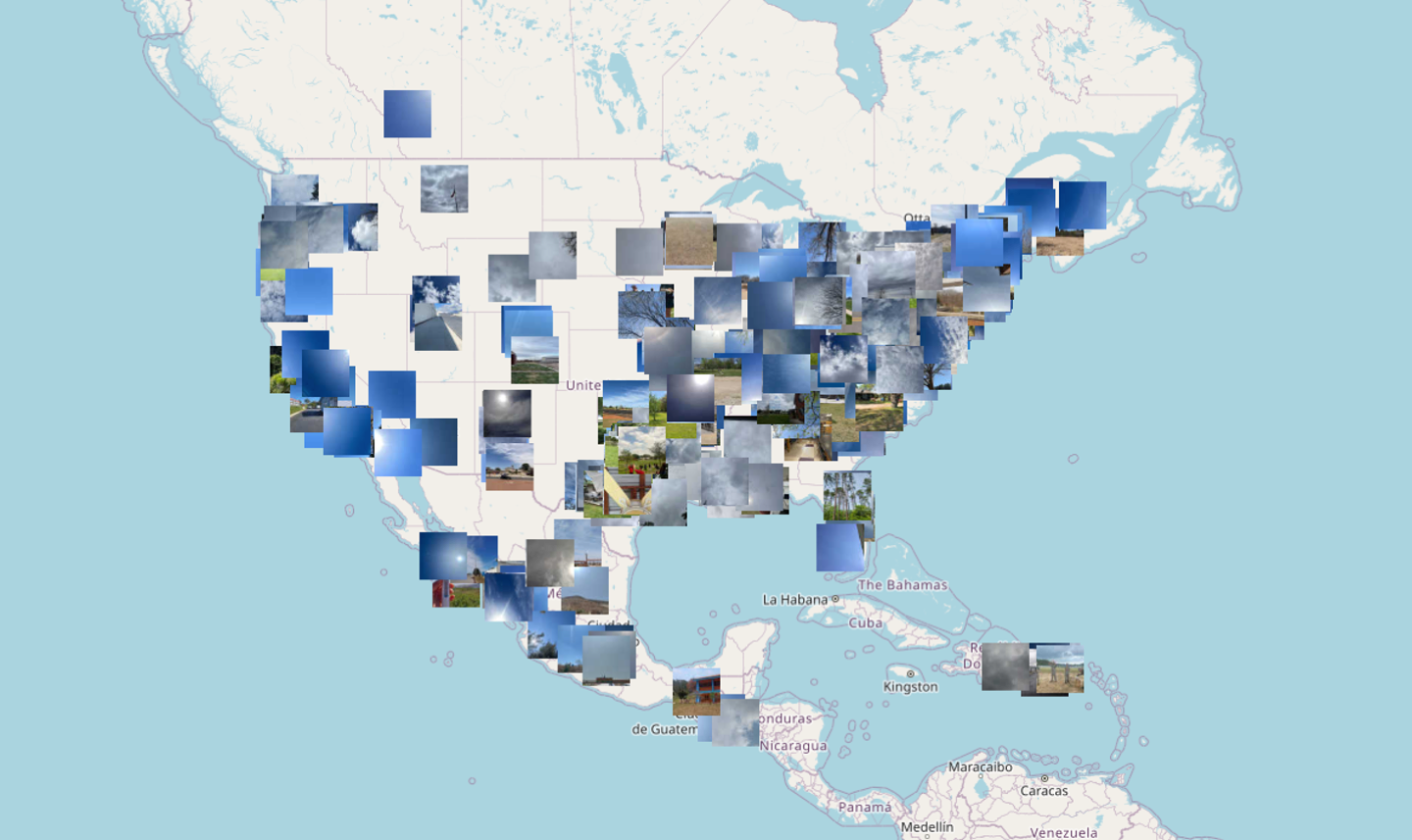
The maps below give a snapshot of the 32,385 air temperature (left), 7,009 clouds (center) and 632 land cover (right) observations collected on 08 April 2024 (data in the database as of 05 November 2024 for the area experiencing any portion of the eclipse). You can go to the day of the eclipse pre-filtered on the GLOBE Visualization System to explore the maps of the data more fully (land cover defaults to one year of data, so the layer settings will need to be changed to show only the day of the eclipse). The 11,735 wind data points are available in the files below, but not pictured in the maps below and not available to be visualized in the GLOBE Visualization System.
The maps below give a snapshot of the 32,385 air temperature (left), 7,009 clouds (center) and 632 land cover (right) observations collected on 08 April 2024 (data in the database as of 05 November 2024 for the area experiencing any portion of the eclipse). You can go to the day of the eclipse pre-filtered on the GLOBE Visualization System to explore the maps of the data more fully (land cover defaults to one year of data, so the layer settings will need to be changed to show only the day of the eclipse). The 11,735 wind data points are available in the files below, but not pictured in the maps below and not available to be visualized in the GLOBE Visualization System.


For the datasets provided, the GLOBE Application Programming Interface (API) was used to retrieve the data, specifically the option to get data constrained by a GeoJSON shape. The shape where the app was visible for the 2024 eclipse was used for the data retrieval. Data are made available in JSON and GeoJSON file formats directly from the API, and also converted into comma separated value (CSV) and Excel (XLSX) file formats. The CSV and XLSX files have some additional columns for each data point as described in the documentation file. The CSV may be more universally accessible without specialized software, but the XLSX format preserves some formatting that may make the files easier to work with. The date the data was pulled is indicated in the filename.


