Snow Photos Delta Junction - GLOBE Observer
Snow and Snowdrift Photos in Delta Junction
Project Description:
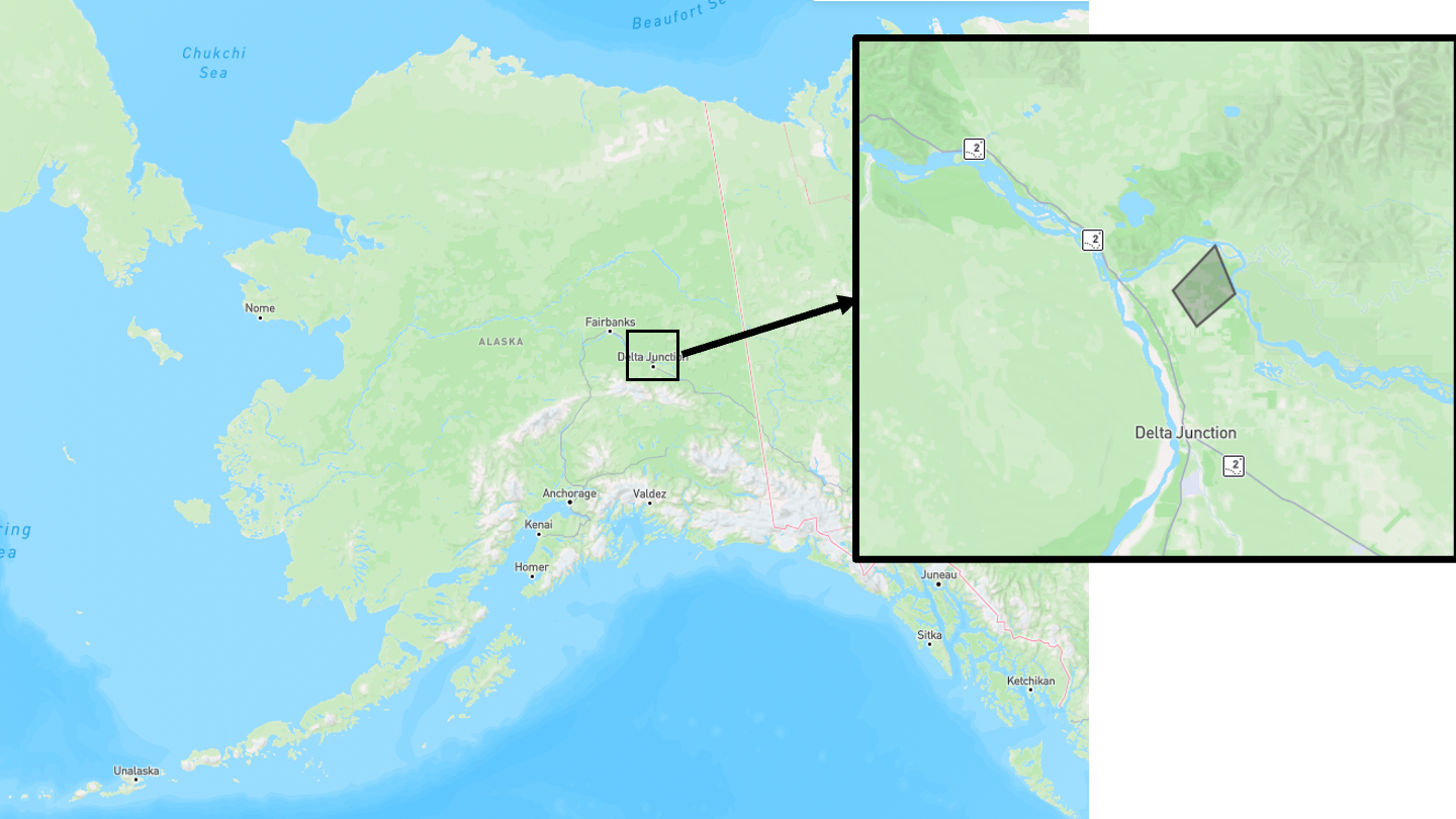
Join the University of Alaska Fairbanks, in collaboration with the NASA Snow Program, the NASA Terrestrial Hydrology Program (THP) and the Delta Junction Trails Association for a participatory science photo collection project from February 1 to February 28, 2025. Use your GLOBE Observer app and mobile device to take land cover photos of snow along the Bluff Cabin Trail. If you notice a snowdrift, please take multiple photos of the drift via the feature photo option.
Snowdrifts store water and melt slower than the surrounding snowpack. Knowing where snowdrifts are can help us develop remote sensing techniques to find, map and estimate snowdrift water content from space.
Snowdrifts store water and melt slower than the surrounding snowpack. Knowing where snowdrifts are can help us develop remote sensing techniques to find, map and estimate snowdrift water content from space.
Project Impact:
Participatory science photos will help us learn about snow and snowdrift characteristics while exploring ways to extract 3D information from overlapping photos. Local optical imagery can validate spaceborne and airborne data.
We will build a story map or webpage for this project prior to the app notification deadline, which will be housed on the Geographic Network of Alaska webpage. This is in conjunction with with GLOBE intensive observing period (IOP) titled "Snow View: GLOBE Photos of Snow in Clouds, Trees and on Land - February 2025."
We will build a story map or webpage for this project prior to the app notification deadline, which will be housed on the Geographic Network of Alaska webpage. This is in conjunction with with GLOBE intensive observing period (IOP) titled "Snow View: GLOBE Photos of Snow in Clouds, Trees and on Land - February 2025."
Protocols Used:
Active Dates:
01 February to 28 February 2025
Special User Instructions and Tags:
Please join the Delta Junction Snowdrifts GLOBE Team.
On the trail, stand in a safe place and follow the in-app instructions to take photos in the up, down and cardinal directions. If a snowdrift is visible, use the in-app instructions to submit a feature photo of the snowdrift. In the caption, write what you observe: does the snow look different than the surrounding snow? Are the snow crystal sizes smaller? What is the shape of the snowdrift? If you are able to measure the depth of the drift with a tool such as a meter stick or an avalanche probe, please provide the snow depth and include units in the caption.
The process of combining multiple photos from various angles to extract three dimensional information is called photogrammetry. If the conditions are safe, please submit photos of the snowdrift from two or more locations.
Region of Interest:

For More Information:
For specific questions, reach out to project contact Julia White.
Short link to this page: https://observer.globe.gov/snow-photos-delta-junction


