


Land Cover Toolkit - GLOBE Observer


Resource Library Quick Facts Tips and Troubleshooting
Some types of land cover could increase a community’s risk of certain disasters, like flooding; while other types, like forests, can absorb carbon dioxide and mitigate the effects of climate change. These are just a couple of reasons why scientists study land cover. Satellites provide frequent, global observations of land cover, but can’t always see the details. You can help by taking observations on the ground using GLOBE Observer.
Lead a LEGO land cover activity or set up a phenology tracking station. These are just a couple of ways to integrate GLOBE Observer into your programming.
Quick Facts
What's the difference between land cover and land use? How do scientists use satellites to study land cover? Prepare for your program or develop a script by reviewing these common questions.
Tips and Troubleshooting
Safety
Remind participants that they should never look directly at the sun. Participants will be looking at the sky and their devices; be sure to choose a location with even ground and away from traffic and other hazards. If you must use a parking lot, try to block off an area for your program.
Location
Plan out your route before the program, and check the day before in order to avoid surprises like downed trees. When choosing a location, keep time, safety considerations, ease of classification and diversity of land cover types in mind.
If your participants are using the app for the first time, you may want to find a location with only one or two types of land cover and few obstructions, such as a grassy field. As participants become more familiar with the app, introduce more complicated areas to classify. Participants will be observing 50 meters of land cover in each direction (a 100m x 100m square). That's approximately the length of a football field. If possible, have participants take their first observation from the middle of a football field. Otherwise, you may want to measure out a 100 meter x 100 meter square at your first observation site. For a more permanent display, install a post in the middle of your "pixel" so that visitors can take repeat observations anytime.
In some instances, you might need to present indoors. You can still demonstrate the app inside-- just don't send the observations to GLOBE. Bring handouts like the GLOBE Observer postcard so that visitors remember to check out the app on their own time.
Presentation Tips
Determine the internet connectivity of your location. If you are providing devices, ensure that the app is downloaded and updated prior to the program. If participants will be using their own devices, ensure that they will have internet access or ask them to download the app prior to their arrival.
Sharing the app on a smartphone is fine for individual interactions, but you may wish to use a tablet with groups so that everyone can see what's on the screen. Ask for volunteers to complete each step so that everyone gets a chance to contribute to the observation.
Land cover affects both the formation of clouds and the availability of mosquito habitat.
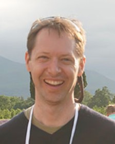 Peder Nelson, Oregon State University, uses GLOBE Observer data to calibrate land cover maps.
Observing our rotating planet on a sun-synchronous orbit, from pole to pole, Terra looks for land cover changes all over the globe. Terra has been contributing to what we know about our Earth’s land cover for almost 20 years, creating one of the longest data records of land cover change from a single satellite mission.