


News - GLOBE Observer


GLOBE Clouds New Satellite Matching: NOAA-20
Leer este artículo en español.
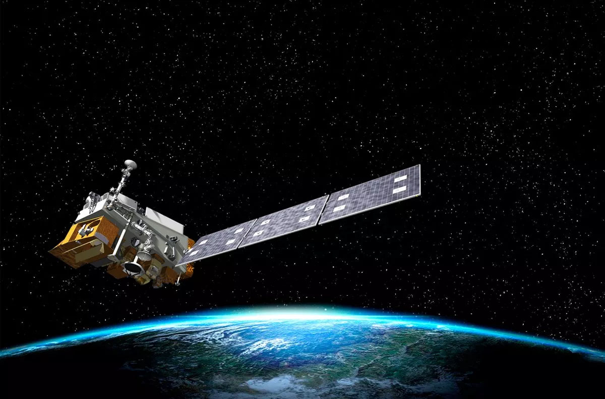
The NASA GLOBE Clouds team is excited to announce the addition of NOAA-20, a new satellite, to the satellite matching capabilities. This means that when you make your cloud observations, you can match your observations to NOAA-20, but what is NOAA-20?
About NOAA-20
NOAA-20, previously known as JPSS-1, is one of five satellites that will comprise the Joint Polar Satellite System, or JPSS. This constellation of satellites orbit one after another along the same track. JPSS satellites circle the Earth from pole-to-pole and cross the equator 14 times daily in the afternoon orbit. This track provides full global coverage of our planet twice a day.
The satellites provide data that informs numerical weather forecasting models. They also gather observations during severe weather events, and will detect and monitor environmental hazards such as droughts, forest fires, poor air quality and harmful coastal waters. You can learn more about JPSS on their education resources page.
The uniqueness of the NOAA-20 satellite is that it carries an extra instrument called CERES or Clouds and Earth’s Radiation Energy System. This instrument is managed at NASA Langley Research Center, which is the home of the GLOBE Clouds team. CERES is used to monitor how clouds impact Earth’s energy budget and climate. Learn more about the impact clouds have on Earth’s climate in this video with Dr. Patrick Taylor of NASA Langley Research Center.
How to get a satellite match to NOAA-20
The NASA GLOBE Clouds team started matching your cloud observations to NOAA-20 this winter. Here are some steps you can practice to enhance your matches with NOAA-20 and with other polar orbiting satellites (Terra, Aqua, CALIPSO).
-
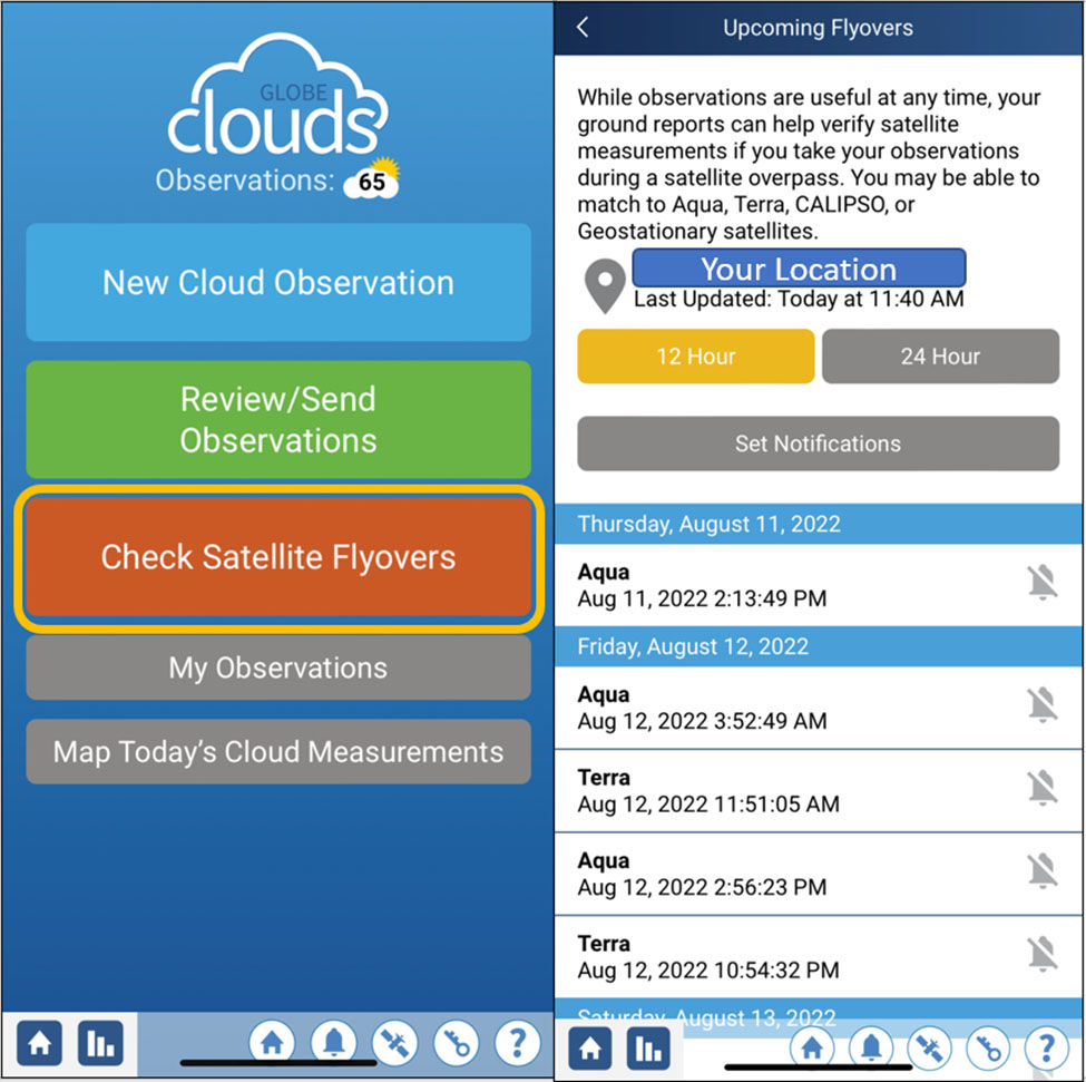
Use the satellite flyover schedule
NOAA-20 is a polar orbiting satellite, so the best way to get a match to your observations is to check the time and date when NOAA-20 will be flying over your area. Click on the orange button on the clouds main page. This will give you a list of all the polar orbiting satellites and when each one will fly over your location.
*Note: Geostationary satellites do not have a flyover schedule. If data is available from these satellites at the time and location you make your cloud observations, you will get a NASA personalized email with your comparisons.
-
Make a cloud observations 15 minutes before or after the selected time
A match to a polar orbiting satellite (Terra, Aqua, CALIPSO, and soon NOAA-20) is accomplished by making a cloud observation within a 15 minute window from the date and time listed on your satellite flyover schedule. Your window to guarantee a satellite match starts 15 minutes before the time listed and ends 15 minutes after. You can even set notifications of upcoming satellite flyovers. Cloud cover, cloud types, and opacity are important information for scientists to receive from your observations.
Example: The first opportunity in the list is for Aqua, which will be in the area at 2:13pm local time. The window to guarantee a satellite match would then be to make a cloud observation anytime between 1:58pm to 2:28pm local time.
Start of Window End of Window 2:13 pm - 0:15 = 1:58 pm local time 2:13 pm + 0:15 = 2:28 pm local time -
Include sky photographs with your cloud observations
Sky photographs give scientists a chance to observe clouds from your point of view. Using photographs taken from the ground view, gives information on the location and opacity of clouds, and the thickness of any reported dust storms or smoke plumes. For this reason, the GLOBE Observer app asks you to take a photograph in each cardinal direction (N, S, E, W), straight up, and one down looking at your land cover type.
Your photographs are important in multiple instances:
- High thin cirrus clouds (usually called sub-visible cirrus) were present and captured in your photographs.
- An event like a dust storm or smoke from nearby fires block your view of sky and clouds.
- Contrails reported in your observations are captured in your photographs.
- When your report and the satellite data do not match.
Satellite imagery is sent whenever a satellite match occurs. You will find these at the bottom of the satellite match table. There are resources to help you analyze the satellite data from GEO, Terra and Aqua, and CALIPSO – in this way you can compare your observations and sky photographs.
About the Author
Marilé Colón Robles is the project scientist for NASA GLOBE Clouds and the principal investigator of NASA GLOBE CLOUD GAZE based out of the Science Directorate at NASA Langley Research Center with Science Systems and Applications, Inc. Marilé works with scientists on ways to include citizen science data into research. She also works with students and teachers around the world to engage students in real-world STEM activities and in authentic science through The GLOBE Program.
Comments
View more GLOBE Observer news here.