Clouds Toolkit - GLOBE Observer

Resource Library Quick Facts Tips and Troubleshooting
Clouds don’t just make rain; they help regulate the Earth's temperature by trapping or blocking the Sun's energy. NASA and other space agencies have a number of satellites orbiting Earth and collecting data about clouds. Combining this global view from above with ground observations of clouds and sky conditions from below helps scientists get a more complete picture of clouds in our atmosphere.
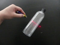
Lead a cloud observation hike and discuss the different types of clouds. Demonstrate how clouds are made and use a laser to show how satellites gather information on clouds. These are just a couple of ways that you can integrate GLOBE Observer into your organization’s programming.
Featured Activities
|
Demonstrate how a cloud forms and investigate it using a laser. |
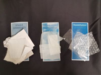
Categorize materials by opacity and understand why cloud opacity matters. |
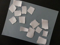
Create a cloud collage and ask your friends to guess the percentage of cloud cover. |
Quick Facts
Do all clouds make rain? How do clouds affect my life? Prepare for your program or develop a script using these common questions.
Tips and Troubleshooting
Safety
Remind participants that they should never look directly at the sun. Participants will be looking at the sky and their devices; be sure to choose a location with even ground and away from traffic and other hazards. If you must use a parking lot, try to block off an area for your program.
Location
In addition to choosing a safe location, you should find an area with few obstructions. One way to check for obstructions is to hold your hand out level with the top of your head. If all obstructions fall below your hand, you've picked a perfect site.
In some instances, you might need to present indoors. You can still demonstrate the app inside-- just don't send the observations to GLOBE. Bring handouts like the GLOBE Observer postcard or the Cloud Identification Chart so that visitors remember to check out the app on their own time.
Presentation Tips
Sharing the app on a smartphone is fine for individual interactions, but you may wish to use a tablet with groups so that everyone can see what's on the screen. Ask for volunteers to complete each step so that everyone gets a chance to contribute to the observation.
Flyover Matching
Observations taken within 15 minutes of a satellite flyover are particularly helpful for studying clouds. You can find upcoming flyovers for the next two weeks by pressing the satellite icon within the Clouds module. Even if you need to select a time more than two weeks in advance of the program, you can still check to see if your program will overlap with a flyover. Most satellites are too small to be seen from the ground, but you can check this website for ISS viewing opportunities. Keep in mind that the best times to see the ISS are typically not the best times for cloud viewing.
If you take an observation 15 minutes before or after flyover, matching satellite images will be emailed to you. Matches from geostationary satellites take about 2 days, but matches from other satellites could take up to 2 weeks. For recurring events, you can simply share the images during the next session, but for one-time programs you might consider printing images from a previous match or posting images on a social media account where participants can see them afterwards (plus, you might just gain new followers).


