


Land Cover Activities - GLOBE Observer


Activities
Find land cover related activities to integrate into carts, demonstrations, classes and more.
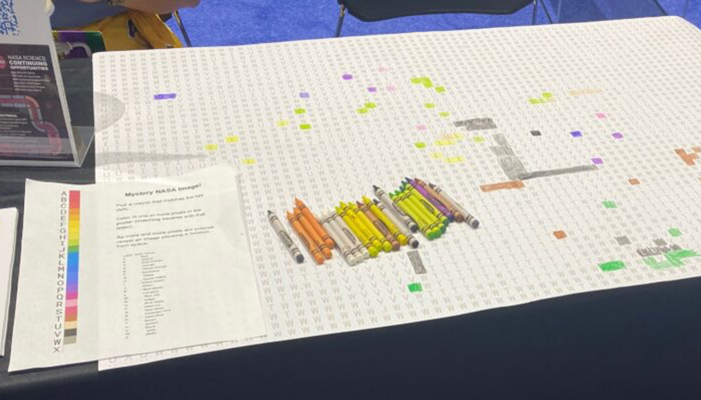
Use a satellite image to generate a gridded poster with a mapped key to match a standard 120-color Crayola crayon palette. The tool outputs a grayscale PDF containing a grid of half inch squares. Each square contains a number indicating the appropriate color to use when filling in, gradually revealing the image as participants collaboratively and collectively color in the grid. The activity can be used at a basic level to demonstrate how satellite images are data, moving on to discussions of how digital digital images are captured, transmitted, and reproduced. For more advanced audiences, it can progress into wavelengths, band-mapping, and more.
Each participant discovers the length of her or his own individual pace (while one pace equals two steps) by taking ten paces three times and finding the average of those three trials. Then participants count paces to experience the distance of 50 meters.
Lead a walk through different types of land cover and explore the differences with participants.
Build a land cover map using blocks or LEGO bricks.
An activity to guide you through making a map, including deciding on a purpose for the map, and adding elements such as a grid, a compass, a scale, a key, symbols, and labels that show how different things relate to each other.
Observation Stations are typically 2' concrete stickers, from which citizen scientists can take observations using the GLOBE Observer app. Observing from a station provides additional information that allows our team to study things like change over time or the accuracy of the app. Download the template file and check out the Facilitator's Guide for guidance on customizing and placing your stations.
This activity allows you to make more detailed and quantitative measurements along four transects of a 50m by 50m square observation area (pixel) that can be compared with the percentages estimated using the GLOBE Observer: Land Cover tool and satellite-based maps.
Explore the history of a location, observe the current state of the location, and make predictions about the future.
Participants pour water onto different kinds of surfaces and discover differences in how those surfaces absorb it.